A polar vortex anomaly of unprecedented intensity for February is bearing down on the Northern Hemisphere, forcing meteorologists to track what some climate scientists are describing as “nearly unprecedented” for this late in the winter season.
The high-altitude winds circling the Arctic are beginning to buckle, wobble, and spill in ways that defy typical February weather patterns. While many regions were already anticipating spring’s arrival with longer days and slightly warmer temperatures, this atmospheric disturbance threatens to plunge frigid Arctic air far southward across North America, Europe, and Asia.
The timing makes this event particularly unusual. By February, winter typically begins loosening its grip on much of the Northern Hemisphere, but this year’s polar vortex disruption is rewriting the seasonal script entirely.

Understanding the Polar Vortex Breakdown
The polar vortex operates like a spinning carousel of strong winds high in the stratosphere, keeping the coldest Arctic air locked tightly around the North Pole. When this spinning ring remains stable, most deep-Arctic chill stays contained, allowing regions farther south to experience typical winter weather.
However, when the vortex becomes disturbed by pulses of warmth, waves in the jet stream, or long-term climate system shifts, it can weaken, split, or sag dramatically. Rather than failing politely, a disrupted vortex droops southward like a heavy curtain of cold, sending tongues of frigid air plunging into populated areas.
This particular anomaly shows signs of significant sagging and warping, threatening to push winter conditions back into regions where residents were already hoping for crocuses and soft soil. The atmospheric mechanics create a domino effect that can reshape weather patterns across entire continents.

Forecasters are tracking dramatic temperature swings in some regions, with potential drops of 10, 15, or even 20 degrees Celsius occurring within just a day or two. Other areas may experience subtler but equally unsettling shifts, including warmer-than-normal winter air being sucked northward on the jet stream’s opposite side.
Physical Signs of the Approaching Anomaly
While the polar vortex itself remains invisible from ground level, its approaching influence creates distinctive atmospheric conditions. The air takes on an almost metallic clarity, with streetlights developing sharp, crystalline halos and sound traveling differently than usual.
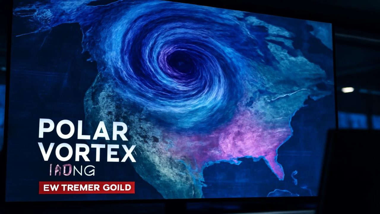
Weather maps begin showing the story first through great bruised swirls of purple and blue surging downward from the Arctic. These colorful representations translate into real-world consequences affecting millions of lives.

| Observable Signs | Description |
|---|---|
| Air Quality | Metallic clarity with unusual sharpness |
| Light Effects | Crystalline halos around streetlights |
| Sound Changes | Distant traffic quieter, footsteps louder |
| Breath Visibility | Quick, ghostly ribbons that vanish rapidly |
Trees begin groaning faintly at night as their trunks contract in response to the cold. The world appears pared down to essentials: ice, air, light, and the thin warmth of human bodies trying to maintain their temperature against the hostile atmosphere.
Real-World Impact on Daily Life
The consequences of this polar vortex anomaly extend far beyond uncomfortable weather. A single night of brutal cold can shatter water pipes, strain electrical power grids to their breaking points, freeze agricultural crops, and transform routine commutes into genuine hazards.
Infrastructure systems designed for typical February conditions may struggle to cope with the intensity of this particular event. The unusual timing means that utilities and emergency services might be caught off-guard, having already begun transitioning away from peak winter preparedness modes.

Agricultural regions face particular vulnerability, as crops and livestock that might normally withstand February conditions could suffer significant damage from the more severe temperatures. The economic ripple effects can extend well beyond the immediate weather event itself.
Transportation networks also face major disruptions. Airlines may need to cancel flights due to extreme cold affecting aircraft operations, while road conditions can become treacherous rapidly as temperatures plummet faster than maintenance crews can respond.
The Science Behind February’s Unusual Intensity
What makes this polar vortex anomaly particularly noteworthy is its occurrence during a month when such intense disruptions rarely happen. Climate scientists are studying the underlying mechanisms that have allowed such a powerful event to develop so late in the winter season.

The term “polar vortex” itself might sound like science fiction, but it represents a very real and measurable atmospheric phenomenon. The current disruption appears to be influenced by complex interactions between various climate systems that meteorologists are still working to fully understand.
Historical weather records show few comparable events occurring in February with this level of intensity. The rarity of such late-season polar vortex breakdowns makes accurate forecasting more challenging, as there are fewer precedents to guide predictions.
Long-term climate patterns may be contributing to the unusual timing and intensity. Changes in Arctic ice coverage, ocean temperatures, and atmospheric circulation patterns all potentially play roles in creating conditions that allow such anomalies to develop.

What to Expect in the Coming Days
Weather forecasts indicate that the effects of this polar vortex anomaly will unfold over several days to weeks, depending on geographic location. The initial impact may be sudden and dramatic in some areas, while others experience a more gradual but persistent shift toward colder conditions.
Emergency management officials are likely monitoring the situation closely and may issue additional warnings as the event develops. Residents in potentially affected areas should prepare for power outages, transportation delays, and other disruptions associated with extreme cold weather.
The duration of the cold snap remains uncertain, as polar vortex events can persist for days or weeks depending on how quickly the atmospheric circulation patterns restabilize. Recovery to normal seasonal temperatures may take longer than typical February cold snaps.

Meteorologists continue tracking the vortex’s movement and intensity, providing updated forecasts as new data becomes available. The unusual nature of this event means that predictions may need frequent revision as the situation evolves.
Frequently Asked Questions
What exactly is a polar vortex anomaly?
It’s a disruption in the spinning band of strong winds high in the stratosphere that normally keeps Arctic cold air contained around the North Pole, causing frigid air to spill southward.
Why is this February event considered unusual?
Climate scientists are describing it as “nearly unprecedented” for February because such intense polar vortex disruptions rarely occur this late in the winter season.

How much colder could temperatures get?
Forecasts suggest some regions could see temperature drops of 10, 15, or even 20 degrees Celsius within a day or two of the anomaly’s arrival.
Which areas will be most affected?
The anomaly is expected to send frigid air into North America, Europe, and Asia, though specific impacts will vary by location and the vortex’s exact path.
How long will the cold conditions last?
The duration remains uncertain and depends on how quickly atmospheric circulation patterns restabilize, potentially lasting days to weeks.
Can this type of event be predicted accurately?
The rarity of such intense February polar vortex events makes accurate forecasting more challenging due to fewer historical precedents to guide predictions.


Leave a Comment