Arctic temperatures are climbing to near-freezing levels during polar night, when regions should be experiencing bone-deep cold of -20°C or lower. As February approaches, meteorologists are describing conditions they’ve never seen before, using words like “unprecedented” and “off the charts” to characterize what’s happening at the top of the planet.
The Arctic, long considered Earth’s frozen anchor point—slow to change and predictably stable—is now behaving in ways that have veteran forecasters scrambling for new language to describe the transformation. The winter freeze-up that has defined the region for generations is faltering in real time.
This isn’t just another warm winter. The scale and speed of change are rewriting the rules of Arctic weather patterns, with consequences that extend far beyond the polar region itself.

The Polar Vortex Is Losing Its Grip
For decades, winter in the high north followed a dependable pattern. Sea ice expanded relentlessly through autumn, thickening through December and January, reaching its maximum extent by late February or March. A strong, well-behaved polar vortex—a deep, cold whirl of air—stayed locked in place over the Arctic like a lid on a freezer chest.
This year, that lid is wobbling dangerously. Relentless pulses of warm air are punching into the Arctic from lower latitudes, riding up along distorted jet streams and slipping past the Arctic Circle. These warm “tongues” of air are gnawing at the cold from within, creating heat anomalies that show up as deep red blobs on meteorologists’ monitors in regions that should be displaying bone-deep blue.
The intrusions aren’t entirely new, but their frequency and intensity are. Meteorologists from Europe to North America are watching, unsettled, as the Arctic flashes warning signs that even veteran forecasters struggle to contextualize within historical experience.

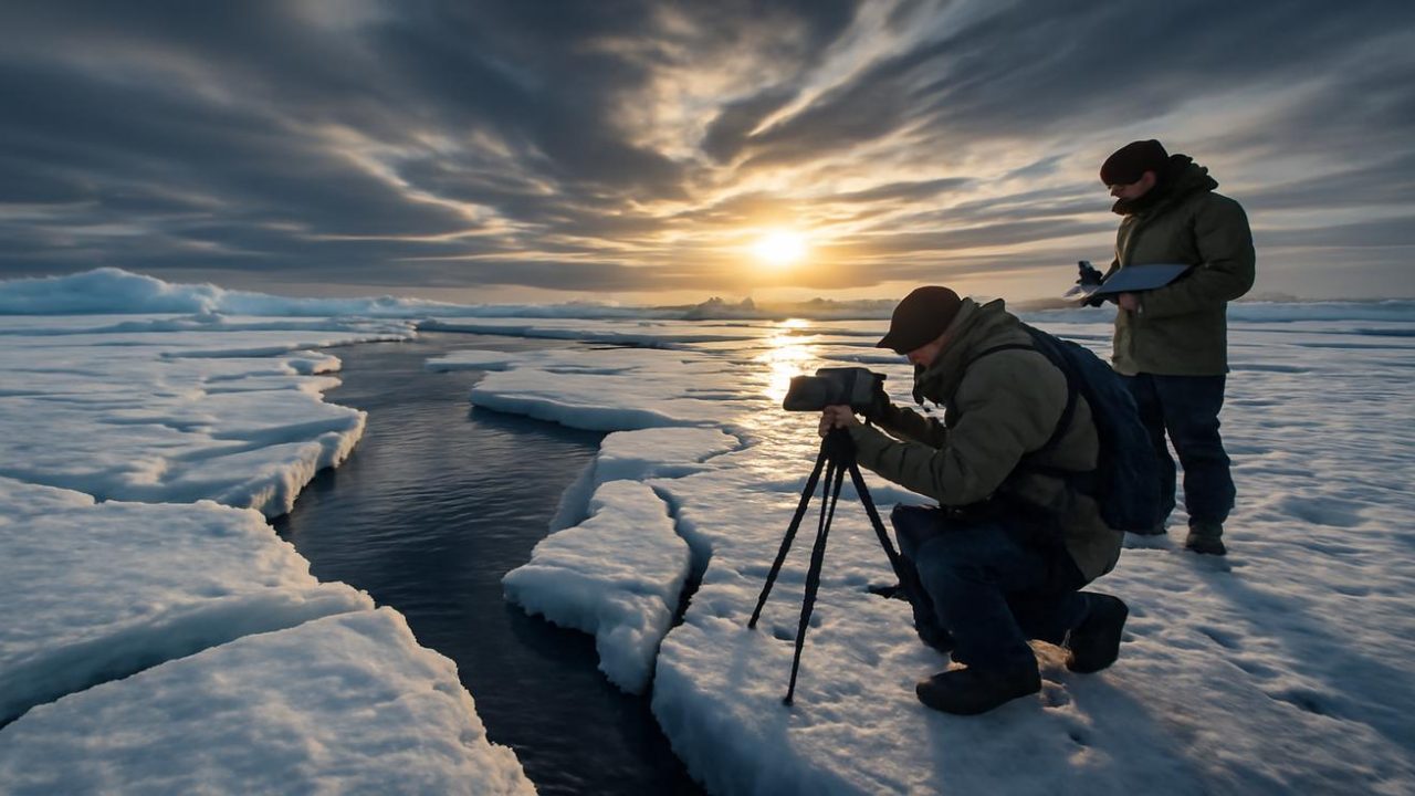
Sea Ice Is Losing the Battle Against Time
The changes aren’t just visible on weather maps—they’re written in the texture of the ice itself. Scientists on winter expeditions are finding thin, uncertain surfaces crazed with fractures and small dark pools that shouldn’t exist until spring. The air temperature may still be below freezing, but the ice feels tired, like something that’s been through too many freeze-thaw cycles in too few years.
Satellite data confirms what researchers are feeling underfoot. The ice isn’t only shrinking in extent; it’s losing its age and thickness. Long-lived, thick, multi-year ice—once the Arctic’s armored core—is giving way to fragile, first-year ice that melts more easily under assault from warming air and water.
Where old ice used to act like a savings account of cold, buffering year-to-year shifts, now there’s mostly seasonal ice, thin as a paycheck that never quite covers the bills. The graphs tell a story that seems almost too neat in its cruelty: winter freeze-up now starts later, advances more slowly, and stalls at smaller extents.

| Arctic Ice Characteristic | Historical Pattern | Current Trend |
|---|---|---|
| Freeze-up timing | Predictable autumn expansion | Starting later each year |
| Ice thickness | Multi-year ice dominance | Mostly thin, first-year ice |
| Maximum extent | Late February/March peak | Smaller, earlier peaks |
| Ice durability | Stable through winter | Fractured, vulnerable to storms |
Storms Are Marching Further North
The weakened ice faces another threat: supercharged storms powered by warmer oceans are marching farther north than ever before. These weather systems, which historically would have been blocked or weakened by stable Arctic conditions, are now finding pathways into regions that once seemed impenetrable.
The combination of thinner ice, warmer air intrusions, and more powerful storms creates a feedback loop that accelerates the deterioration. Each element reinforces the others, making the Arctic more vulnerable to the next wave of unusual weather.
Meteorologists describe watching this unfold with a mixture of scientific fascination and professional concern. The models and historical data that have guided Arctic forecasting for generations are increasingly inadequate for predicting what comes next.

Why This Matters Beyond the Arctic Circle
The Arctic’s transformation doesn’t stay contained within polar regions. The jet stream distortions that allow warm air to penetrate the Arctic also enable frigid air to spill southward into lower latitudes, creating the extreme weather whiplash that has become increasingly common across North America and Europe.
When the polar vortex weakens and wobbles, it can send Arctic air plunging into regions unprepared for such extreme cold, while simultaneously allowing subtropical warmth to reach areas that depend on winter’s predictable chill. This disruption affects everything from agriculture to energy systems to transportation networks.
The loss of old, thick sea ice also removes one of the planet’s most effective cooling mechanisms. White ice reflects sunlight back to space, but dark ocean water absorbs it, creating additional warming that extends far beyond the immediate region.

February Will Test New Limits
As February approaches—traditionally the month when Arctic sea ice reaches its maximum extent—meteorologists are preparing for conditions that may redefine what’s considered normal for the season. The current trajectory suggests this winter’s ice maximum could set new records for minimal coverage and thickness.
The silence that has long characterized the Arctic winter—described as deeper and older than any countryside quiet, heavy as snow—now carries a different weight. It’s the silence of a system in transition, of patterns breaking down faster than new ones can establish themselves.
For researchers and forecasters who have spent careers learning to read the sky, ice, and air of the polar regions, this winter represents uncharted territory. The language they’ve developed over decades to describe Arctic conditions is proving inadequate for the reality they’re now witnessing.

The implications extend beyond scientific curiosity. Communities throughout the Arctic depend on predictable ice conditions for transportation, hunting, and cultural practices that have sustained them for generations. Weather patterns that affect billions of people in lower latitudes are increasingly influenced by what happens in these rapidly changing polar regions.
Frequently Asked Questions
What temperatures are meteorologists seeing in the Arctic that concern them?
Regions that should be experiencing -20°C or colder are seeing temperatures near freezing during polar night, when the area receives no sunlight.
How is this winter different from previous warm Arctic winters?
While warm air intrusions into the Arctic have happened before, the scale and speed of change this winter are unprecedented, with meteorologists struggling to find historical context for current conditions.

What’s happening to Arctic sea ice?
The ice is not only shrinking in extent but losing its age and thickness, with fragile first-year ice replacing the thick, multi-year ice that once dominated the region.
Why does Arctic warming affect weather in other parts of the world?
When the polar vortex weakens, it allows Arctic air to spill into lower latitudes while warm air penetrates the Arctic, creating extreme weather patterns across North America and Europe.
When will we know the full extent of this winter’s ice loss?
Arctic sea ice typically reaches its maximum extent in late February or March, so the coming weeks will reveal how this winter compares to historical records.

Are these changes permanent?
The source material does not address whether these changes are reversible or what long-term patterns might emerge from current conditions.


Leave a Comment