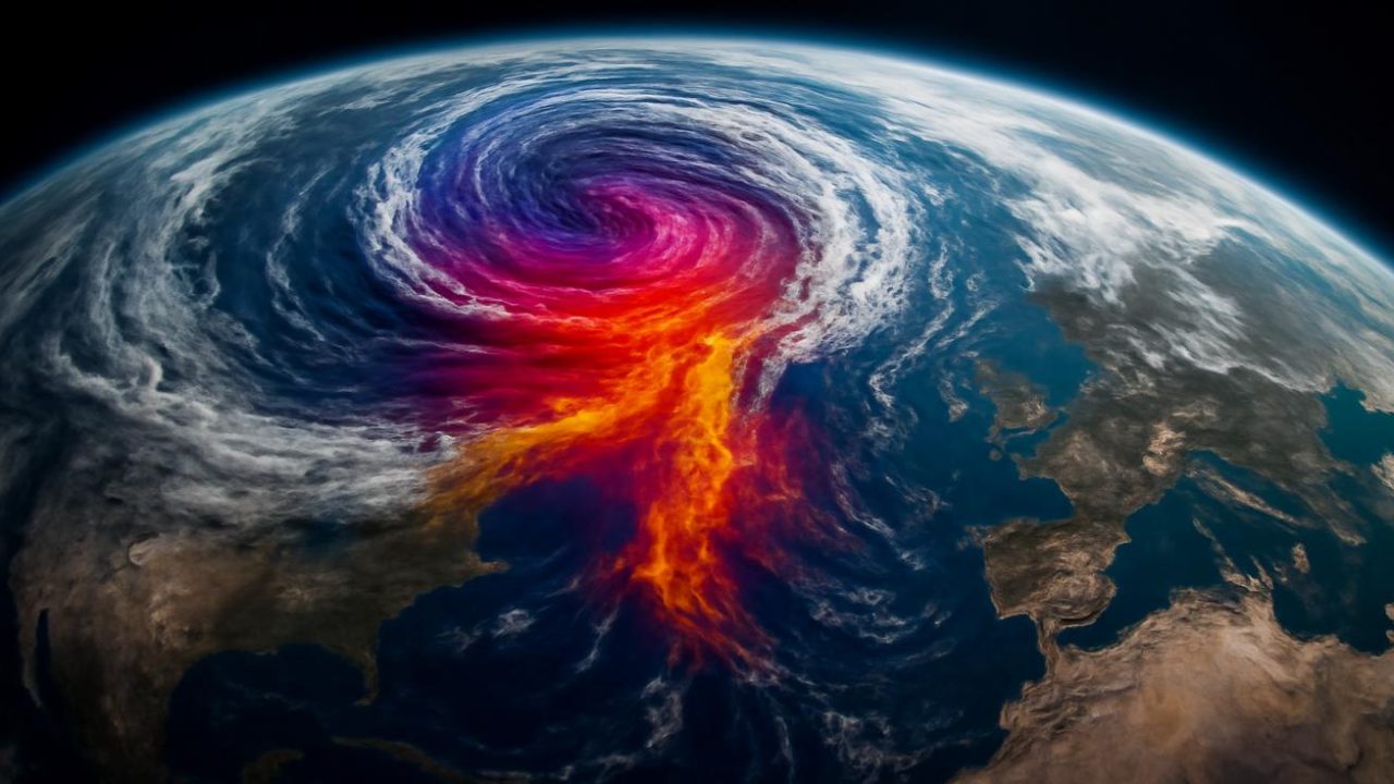
An extraordinary atmospheric event is unfolding high above the Arctic that could dramatically reshape weather patterns across much of the Northern Hemisphere in the coming weeks. Scientists are tracking what they’re calling an exceptionally powerful polar vortex disruption occurring in March—a timing that makes this year’s event particularly unusual and potentially impactful.
The polar vortex, a massive ring of cold air that typically acts like an invisible fence keeping Arctic temperatures locked in place, is beginning to weaken and potentially split apart. What makes this disruption remarkable isn’t just its intensity, but when it’s happening: March disruptions of this magnitude are rare, arriving at a time when winter is supposed to be loosening its grip.
Atmospheric scientists monitoring the situation say the signals in their data are unusually strong and clear, suggesting this could be one of the most significant late-winter polar vortex events on record.

Understanding the Polar Vortex and Why It Matters
The polar vortex exists in the stratosphere, roughly 20 to 50 kilometers above Earth’s surface. Think of it as a giant spinning top of frigid air anchored by the contrast between the dark, cold Arctic and the sunlit, warmer regions further south.
Under normal conditions, this invisible barrier of wind—which can reach speeds exceeding 100 mph—keeps the coldest air bottled up near the North Pole. The vortex typically maintains a circular, stable shape throughout winter, allowing mid-latitude regions to experience their usual mix of cold fronts, warm-ups, and seasonal weather patterns.
But the atmosphere is never completely still. Energy waves from mountains, storm systems, and temperature contrasts travel upward from the lower atmosphere into the stratosphere. Most of the time, these waves cause only minor wobbles in the vortex.

Sometimes, however, these atmospheric waves arrive in powerful, synchronized pulses that can destabilize the entire system. When conditions align perfectly, they can trigger what scientists call a sudden stratospheric warming event—temperatures in the stratosphere can spike by 30 to 50 degrees Celsius within just days.
Why This March Polar Vortex Event Is Raising Eyebrows
Polar vortex disruptions aren’t new phenomena. Scientists have been documenting and studying them for decades. What’s making this year’s event stand out is both its timing and intensity.
Strong polar vortex disruptions typically occur in December or January, when the temperature contrast between the Arctic and mid-latitudes is at its peak. A disruption of this magnitude happening in March is like “winter deciding to throw a surprise party after everyone has already packed up the decorations and started planning for spring,” as atmospheric researchers describe the unusual timing.

Computer models monitoring the stratosphere are showing dramatic changes, with the typically circular wind patterns beginning to stretch, distort, and potentially fragment. The visual representations on scientists’ screens are transforming from neat circular patterns into irregular, spider-like formations.
When the polar vortex weakens or splits, the invisible fence that contains Arctic air develops gaps and openings. Cold air that was previously locked in place near the North Pole can suddenly find escape routes, potentially flooding into regions that have been experiencing milder late-winter conditions.
Potential Weather Impacts and Timeline
The effects of a polar vortex disruption don’t happen immediately. There’s typically a delay of one to three weeks between when the stratospheric event occurs and when surface weather patterns begin to shift dramatically.

Here’s what meteorologists are watching for in the coming weeks:
- Sudden temperature drops in regions that have been experiencing mild late-winter weather
- Potential late-season snow and ice storms in areas already transitioning toward spring
- Disruption of normal jet stream patterns, leading to more erratic weather swings
- Possible extension of winter-like conditions well into what should be spring weather patterns
The geographic impact could be substantial. When the polar vortex weakens or splits, Arctic air masses can surge much further south than typical for this time of year, potentially affecting weather patterns across North America, Europe, and Asia.
| Atmospheric Level | Current Changes | Typical Timeline to Surface Impact |
|---|---|---|
| Stratosphere (20-50 km) | Rapid warming, vortex distortion | Immediate |
| Upper Troposphere (10-15 km) | Jet stream disruption beginning | 1-2 weeks |
| Surface Weather | Normal patterns continuing | 2-4 weeks |
What Makes This Different from Typical Winter Weather
The March timing of this polar vortex disruption creates a unique meteorological situation. By this point in the year, many regions have begun their transition toward spring weather patterns. Daylight hours are increasing, snow cover is typically retreating, and both ecosystems and human infrastructure are preparing for warmer conditions.

A sudden influx of Arctic air during this transition period can create more dramatic contrasts than similar cold outbreaks earlier in winter. The temperature swings can be more jarring, and the impact on everything from agriculture to energy systems can be more pronounced when cold air arrives unexpectedly during what should be a warming trend.
Agricultural regions that have begun preparing for spring planting could face unexpected freezing conditions. Energy systems that have scaled back winter operations might need to rapidly increase heating capacity. Transportation networks that have reduced winter weather preparations could encounter sudden ice and snow conditions.
Monitoring and Prediction Challenges
While scientists can detect the stratospheric changes happening now with considerable accuracy, predicting exactly when and where the surface weather impacts will occur remains challenging. The atmosphere is a complex system, and the path from stratospheric disruption to surface weather changes involves multiple interconnected processes.

Modern weather prediction models are better than ever at tracking these events, but the specific timing, intensity, and geographic distribution of impacts still involve significant uncertainty. What scientists can say with confidence is that some form of significant weather disruption is likely in the coming weeks—the question is where and how severe.
Research into polar vortex behavior has intensified in recent years as scientists work to better understand these dramatic atmospheric events and improve prediction capabilities. Each major disruption provides valuable data that helps refine models and understanding of these complex systems.
Frequently Asked Questions
What exactly is happening to the polar vortex right now?
The polar vortex is experiencing rapid warming and distortion in the stratosphere, with wind patterns stretching and potentially splitting apart due to powerful atmospheric waves.
When will surface weather be affected?
Surface weather impacts typically occur 1-3 weeks after stratospheric changes begin, meaning effects could start appearing in late March or early April.
Why is a March polar vortex disruption so unusual?
Most strong polar vortex disruptions occur in December or January when temperature contrasts are greatest, making this late-winter event exceptionally rare.
How long could the weather impacts last?
Weather disruptions from polar vortex events can persist for several weeks to over a month, potentially extending winter-like conditions well into spring.

Which regions are most likely to be affected?
While specific impacts are still uncertain, North America, Europe, and Asia could all experience sudden temperature drops and unusual late-season winter weather.
Is this related to climate change?
The relationship between polar vortex disruptions and climate change is an active area of research, but this specific event’s connection to longer-term climate trends has not yet been determined.


Leave a Comment