Temperatures in the Arctic stratosphere are expected to spike by 40 to 50 degrees Celsius above normal this February, signaling an almost unprecedented polar vortex disruption that could reshape winter weather patterns across the globe.
This atmospheric upheaval is happening more than 10 miles above Earth’s surface, where winds that normally race in disciplined circles at over 100 miles per hour are stumbling, slowing, and breaking apart. What meteorologists call a “sudden stratospheric warming” is unfolding with unusual timing and intensity for mid-February.
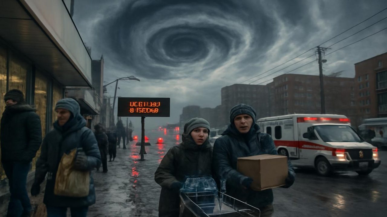
The polar vortex disruption represents one of the most powerful weather events of the year, yet it remains largely invisible to the billions of people who will eventually feel its effects at ground level.

How the Arctic’s Atmospheric Engine Is Breaking Down
The polar vortex operates like winter’s operating system—a colossal, invisible whirlpool of air locked over the Arctic in the stratosphere. Under normal conditions, this vortex spins like a well-rehearsed dancer, keeping brutal cold corralled near the pole through fierce west-to-east winds.
But high-altitude waves have been hammering at the vortex for weeks. These ridges and troughs of air, pushed upward by mountains, jet streams, and sprawling weather systems, act like hands on a dancer’s shoulder, nudging the vortex off balance.
When enough of these atmospheric nudges align, the vortex doesn’t just wobble—it cracks. The winds at the core are projected to weaken dramatically and potentially even reverse direction entirely.

This kind of sudden stratospheric warming happens roughly every couple of winters on average. However, what’s developing now stands out for its timing, scale, and the sheer ferocity of change unfolding above the pole.
Why February Makes This Polar Vortex Event So Unusual
February disruptions of this magnitude are almost unheard of in climate records. Winter is supposed to be slowly loosening its grip by mid-February, not unleashing one of its most powerful atmospheric reorganizations.
The current disruption shows the vortex becoming seriously distorted and possibly splitting into separate lobes. Instead of one coherent whirlpool, the system could shatter into two or more smaller swirls, each dragging its own pool of frigid air along different paths.

These fragmented pools don’t always head for the same destinations. Sometimes they soak Siberia, sometimes North America, sometimes Europe. But the more broken the vortex becomes, the greater the odds that one of those lobes parks itself in mid-latitudes where billions of people live.
| Atmospheric Layer | Normal Conditions | During Disruption |
|---|---|---|
| Stratosphere (10+ miles up) | Tight vortex, winds 100+ mph | Weakened/reversed winds, 40-50°C temperature spike |
| Jet Stream | Relatively stable flow | Buckling into deeper waves |
| Surface Weather | Typical winter patterns | Cold air spills into mid-latitudes |
The Invisible Timeline: When Stratospheric Chaos Reaches Ground Level
If this atmospheric drama stayed locked in the stratosphere, it would remain a scientific curiosity. But the atmosphere consists of interconnected layers, not separate worlds. What happens at the top eventually echoes downward through the entire system.
That echo doesn’t arrive overnight. The full consequences of a powerful polar vortex disruption typically take one to three weeks to work their way down to surface weather patterns that people actually experience.

During this lag time, forecasters watch for telltale signs: the jet stream buckling into deeper waves, high-pressure domes strengthening in the Arctic, and tongues of cold air poised to spill southward like overturned ink.
Long-range forecasting tools are already hinting at a reshaped late-winter pattern, with blocking highs potentially anchoring over Greenland or the Arctic and altered storm tracks across multiple continents.
What This Means for Weather Patterns Worldwide
The magnitude of this February disruption suggests more forceful changes could be coming to surface weather patterns. When the polar vortex becomes severely distorted or splits, it often leads to dramatic temperature swings and unusual weather events in populated areas.

The broken vortex pieces can establish semi-permanent features that persist for weeks, fundamentally altering where cold air flows and where storms develop. These changes don’t affect just one region—they can reshape weather patterns across entire continents.
People living in mid-latitude regions may experience the most noticeable impacts. Cold snaps that seemed unlikely for late winter could suddenly become probable, while other areas might see unseasonably warm conditions as atmospheric circulation patterns reorganize.
The timing makes this disruption particularly significant. February typically marks winter’s gradual retreat, but a major vortex breakdown could extend harsh conditions well into what should be the transition toward spring.

Tracking the Atmospheric Aftermath
Meteorologists will be closely monitoring how this stratospheric warming event propagates through the atmospheric layers over the coming weeks. The key indicators include jet stream positioning, Arctic pressure patterns, and temperature anomalies spreading into lower latitudes.
The full impact timeline remains uncertain, as these massive atmospheric reorganizations follow complex physics that can play out differently each time. Some effects may become apparent within days, while others could take weeks to fully manifest in daily weather patterns.
What remains clear is that this February polar vortex disruption represents an extraordinary atmospheric event occurring at an unusual time of year. Its ultimate effects on global weather patterns will depend on exactly how the stratospheric changes propagate downward through the interconnected layers of Earth’s atmosphere.
For now, the drama unfolds invisibly miles above, where temperatures are spiking and winds are failing in ways that will eventually reshape the weather experienced by billions of people below.
Frequently Asked Questions
What exactly is a polar vortex disruption?
It’s when the high-altitude ring of cold air and strong winds over the Arctic breaks apart or weakens, typically causing the jet stream to become more unstable and allowing cold air to spill into lower latitudes.
How rare is a February polar vortex event of this magnitude?
According to the source material, this magnitude of disruption in February is “almost unheard of” in climate records, making it an exceptionally unusual event for this time of year.

When will people start feeling the effects of this disruption?
The full consequences typically take one to three weeks to work their way down from the stratosphere to surface weather patterns that people experience daily.
Will this affect the entire world or just certain regions?
When the polar vortex splits into separate lobes, different regions can be affected differently—sometimes impacting Siberia, North America, Europe, or combinations of these areas depending on where the broken pieces move.
How much are stratospheric temperatures expected to increase?
Temperatures at the top of the stratosphere over the Arctic are projected to spike by 40 to 50 degrees Celsius above normal levels during this event.
Could this extend winter weather into spring?
The timing of this major disruption in February, when winter typically begins loosening its grip, suggests it could potentially extend harsh conditions into what should be the transition toward spring, though specific outcomes depend on how the event unfolds.


Leave a Comment